
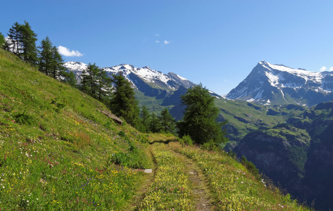
Now is the perfect time to start exploring the outdoors again. It looks like spring has finally arrived for us, with the weather forecast set to hit the low twenties later this week, it’s the perfect chance to get back outside and enjoy all that nature has to offer. Did you know that Switzerland has one of the densest and most varied hiking trial networks in the world? With over 65,000km of mountain and hiking trials available there is no reason not to find one to suit everybody. Switzerland is one of the few countries in the world with a standardised system of “signposted” trails. We’re going to explain the different trails available and how to decode the signposts, so that you don’t end up on the wrong trail and find yourself wondering why you are surrounded by cyclists when you thought you were on a hiking trail.
Switzerland Mobility…
Swiss Mobility is the all-encompassing site where you can access information on the routes:
- Printable route maps
- Highlights of the route
- Level of difficulty
- Route elevation profile
- Photo Gallery
- Helpful hints and tips: SBB timetables, destination websites, tips, etc
Over all it’s a a very easy website to navigate around. It’s available in English, German, French and Italian. You can choose from national, local or regional routes along with which kind of activity your looking to do. It will give you all the details from what conditions to expect, to the level the trail is recommended for i.e. easy, medium or difficult – so you don’t have to worry about going out of your comfort level if you don’t want too. They also have a Switzerland Mobility Plus, which you will need to register for in order to use the site. This is more for the advanced hikers as you can draw your own route online or through their app as well.
Decoding the signs & trials…
To begin with official hiking paths (Wanderweg) have yellow signposts and will have both the destination name and the length of time it takes the average walker to get there. Generally they are accessible trials and are not surfaced with asphalt or concrete. Good hiking boots and a rucksack with some warm clothes, fluids and a snack are the most important items that you will need for the these trails.
A great resource is the Swiss Hiking Federation, they have lots of tips and routes for you to explore.
Mountain hikes (Bergweg) also have a yellow signpost but with two white and a red stripes at the tip of the arrow. They are mostly steep, narrow and can be on difficult terrain. Sections of the trail that are particularly difficult will be secured with ropes and chains. If you’re going to head out on a mountain hike,it’s advised that you are physically fit, surefooted, don’t have a fear of heights and that you have a strong knowledge of the dangers in the mountains.
Alpine hike (Alpinweg) signs are blue with two white and one blue stripe at its tip. These are very challenging trails and depending on which route you choose to take, you might even find yourself hiking across glaciers and through rockfall areas. You need to be aware of the risks when undertaking certain routes under this category as you cannot assume that that safety or structural precautions are in place – after all you are in the heart (and hands) of mother nature. It goes without saying that a certain level of physical fitness is required along with the necessary equipment (ropes, pick axe, compass etc).
Sometimes as you are happily heading along your path you will find a diamond shaped yellow mark on a tree or the colours of the trail your on painted on a rock. This is to show you that you are still on the trail – a glimmer of hope in the event that you felt you were heading in the wrong direction!
The Numbering System…
When you are on a trail route, you will come across numbers on signposts. The numbering on the Swiss signpost system indicates what type of route it is:
- One-digit numbers: National routes
- Two-digit numbers: Regional routes
- Three-digit numbers: Local routes
Colour Co-ordinated Routes…
Each route is colour coordinated distinguishing the types of trails:
Hiking – Green
Cycling – Blue
Mountainbiking – Ocre
In-line Skating – Violet
Canoeing – Turqouise
Maps…
National, regional, and local maps are available for purchase at Swiss Post offices and some book/magazine shops. They are published in English, German, French and Italian. The maps are published by SuisseMobile and are normally waterproof and updated yearly.
These maps also contain information such as the locations of campgrounds, panoramic viewpoints, points of interest, castles, ruins, monuments, restaurants, and barbecue sites.
Last but not least…
If you are travelling on the train with a bike, don’t forget to purchase a bike ticket. They cost around CHF 10 and failure to do this will cost you a fine of around CHF 20. Better to be prepared then to learn the hard way.
Make sure you are well prepared before you head out on any trial and check online for any dangers that are known in that area. Have plenty of water and snacks in a backpack; all weather jacket; extra pair of socks; compass; maps; back-up charger for your phone. Swiss Hiking are a great resource for this and also highlight the acronoym PEAK (PACE in English) as a check list for you to use.
P – Plan
A – Assess
C – Consider
E – Evaluate
Let someone know where you are going, especially if you are going to take a more challenging route by yourself.
